Three short histories of Millis, Massachusetts - how the town was born,
the war that scarred its early land, and the river that powered its rise.
A Brief History of Millis - How East Medway Became its Own Town in 1885
By Liam Termini
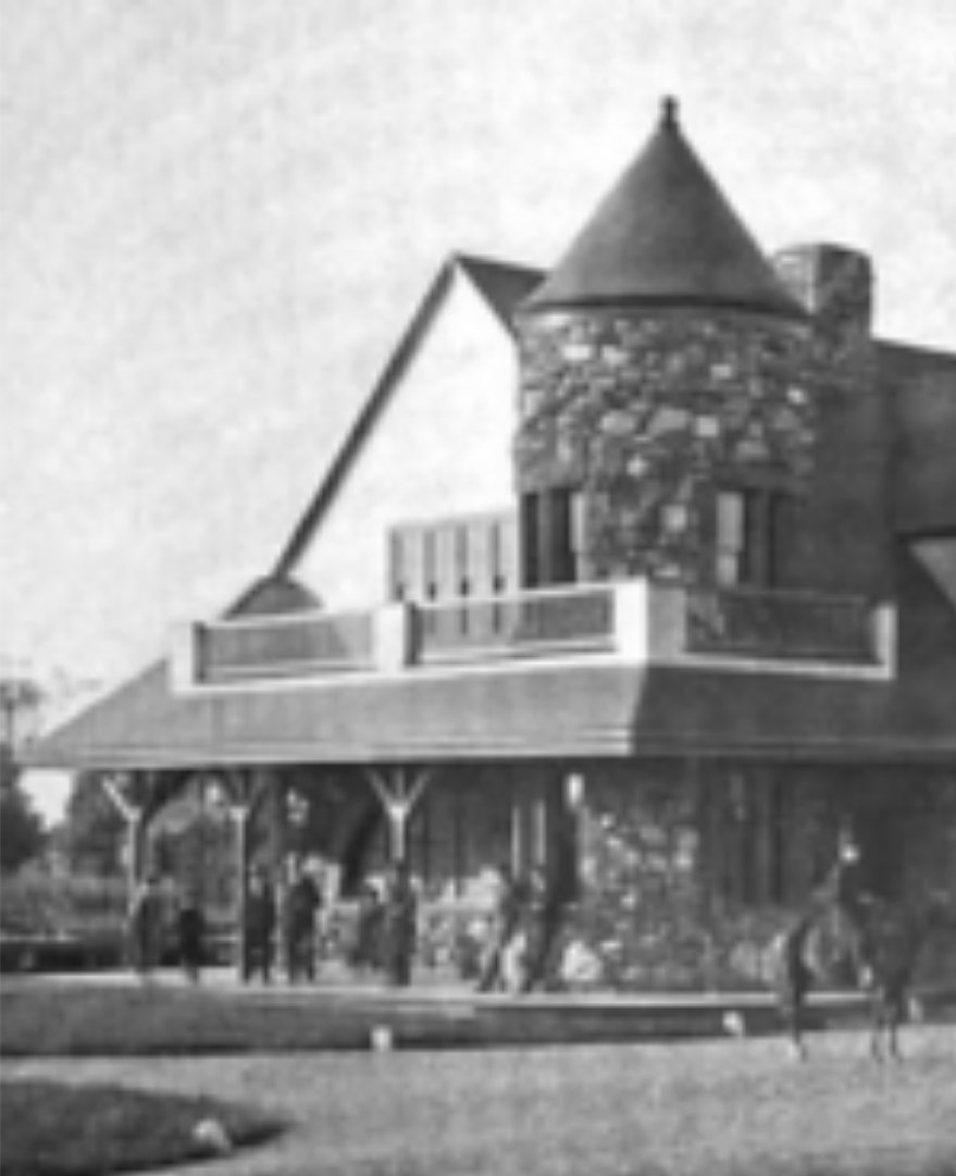
The Millis train station, which helped carry the town's manufactured goods to market.
Photo: Millis Historic Trail
The arrival of European settlers in the early 17th century drastically changed the land we
know today as America. The Pilgrims, a group of Puritans seeking religious freedom, landed
in Plymouth Harbor on November 11th, 1620. With the arrival of these new European settlers,
society adapted to a new form of living with the aid of Native Americans - up until
the point when Native Americans tried removing colonists from their ancestral lands. Millis,
a small town located in modern day Norfolk County, was originally part of Dedham. Dedham
granted these lands (modern day Millis) to another thriving town, Medfield. Half a century
later in 1713, Medfield applied for a grant to establish a new town, Medway. Medway, for a
century and a half, was known as West and East Medway - a thriving community that was
located alongside the Charles River. Medway was originally created by pioneers who wanted to
remain close to the Charles River, for many distinctive reasons. For one, the river allowed
for fertile land to raise animals, grow crops, and provide fresh water to the colonists.
Colonists also disfavored long walks to attend their religious obligations - which
were on the other side of town. The only way to access the community's churches was through
rugged paths - whether there be rain or sun. Thus, the town of Medway was established,
alongside a meeting house and newly created churches.
As time went on, America had arrived in a time period known as the Industrial Revolution
- where machinery had outgrown former agricultural ways of producing goods. Medway,
through the resources provided by the Charles River, became a small manufacturing town,
boosting its economic status. Because of the large growth in industry and manufacturing in
Medway, through their independence and reliability of the Charles River, East Medway split
off from West Medway to become Millis. Millis was able to utilize their manufacturing goods,
alongside their ability to transport these goods through trains, to continue thriving after
departing from Medway. The name Millis derives from one of the founders of the town, who
helped lead East Medway to split from West Medway, Lansing Millis.
Resources used: Medway History; Millis.
King Philip's War: Ties to Millis, Massachusetts
By Liam Termini
Historic image: King Philip's War
A depiction of the raids of King Philip's War (1675-76).
Photo credit: public domain illustration (image TBD)
King Philip's War (1675-76) is known as one of the "bloodiest" wars on American soil,
as around 8,000 soldiers were killed in combat between both the Native Americans and the
English settlers. Native Americans, such as the Wampanoags from New England, were forced to
choose a side - to fight against or alongside the English soldiers. Millis, believe it
or not, was actually a major battlefield in the war - serving as one of the three
major combat areas in the modern-day Norfolk County. These areas - Millis, Medway,
& Dedham - were severely targeted by two Native American tribes, the Nipmuc and the
Wampanoag. Metacom Philip, the son of the Wampanoag's chief Massasoit, led the last major
rebellion against the English colonization in what we know today as America, hence why the
war received the title of "King Philip's War." Land claims had become the deadliest dispute
between Natives and Colonists, due to the fact that neither side wanted to capitulate their
foes.
In February 1676, both Medway and Millis were torched by a mix of Nipmuc and Narragansett
warriors, the largest recorded battle in Millis history. The original goal of the Natives had
been to push back the English settlers even farther, although the Charles River became a major
asset to whichever side could access its benefits. This 80 mile river that led to Boston
Harbor, the largest port in America at the time, was an important asset to traverse the
Massachusetts Bay Colony. The river also gave access to an abundance of fish, allowing for
well-fed families and trade between the English and allied Native Americans. After a victory
for King Philip, a feast was held on February 21, 1676, at the modern-day "King Philip Trees"
in the Millis Historical Society.
Although the significant battles in Millis and Medway were in favor of the Wampanoag and the
Nipmuc, the English settlers pushed back the Native Americans in the late spring of 1676. As
the Native Americans were pushed back to the west, it would secure the victory of English
colonial settlers as the year progressed. In winning the war, it would secure the future of
America one century later when the Declaration of Independence was passed by Thomas Jefferson,
one of our founding fathers and the author of the Declaration of Independence.
Resources used: Britannica, "King Philip's War";
History of Massachusetts, "What Was King Philip's War?"
The Charles River & How Water Power Built the Millis Economy
By Liam Termini
Historic image: a mill village on the Charles River
A 19th-century mill village along the Charles River.
Photo credit: Yale University collections (image TBD)
The Charles River, a vital river to the economy of cities and towns spanned across the
river's 80 miles, was given its name in honor of Prince Charles back in 1614. The Charles
River provided resources and natural goods to the Wampanoag and the Pawtucket - two
distinct Native American tribes who dominated the areas surrounding the precious river before
the arrival of European colonists. After the arrival of Pilgrims in the early 17th century,
colonialism tore away at the natural resources the river provided, profoundly polluting the
river and diminishing certain goods such as fish and clean water these Native American tribes
relied upon. This once beautiful river remained polluted for two centuries, until in 1844, a
notable landscape architect devised a plan to restore the Charles River to its original state.
In 1844, Charles Eliot successfully established his three-step plan to restore the once
thriving river. His plan returned the river to the public, created the Charles River Dam to
stabilize water levels and manage pollution, and established the Storrow Drive Memorial
Embankment. The Charles River, as it was during pre-colonial days, would provide a significant
role in the following years to create a permanent source of wealth for the surrounding
economies - one of these being Millis.
Millis, one of the many small economies surrounding the Charles River, began utilizing the
economic opportunities it provided during the Industrial Revolution - a time of mass
production and a transfer from agriculture to machine based industry. By utilizing this
coveted river, Millis was able to harness the river to raise their own small-town industrial
manufacturing. Small mills evolved into specialized manufacturing centers, which helped drive
Millis's economy for years to come. For one, it introduced jobs in both textiles and textile
machines, leading to population growth as time went on. With the introduction of new jobs,
many individuals sought a better chance at wealth through these new openings. All together,
the Charles River area itself was flourishing with new goods, new jobs, and even a new Millis
- all which helped grow the economy through water power.
Resources used: Yale University (image and
information); Charles River history.
Additional references
"Millis, Massachusetts," Wikipedia. First settled 1657; incorporated Feb. 24, 1885; named for railroad builder Lansing Millis. en.wikipedia.org.
"Prospect Hill Cemetery (Millis, Massachusetts)," Wikipedia. Founded 1714; listed on the National Register of Historic Places (Mar. 15, 2006). en.wikipedia.org.